MountainUNESCO World Heritage
Rwenzori Mountains National Park
Uganda 996 km² (385 mi²) Est. 1991
About Rwenzori Mountains National Park
Rwenzori Mountains National Park protects the highest mountain range in Africa, the legendary Mountains of the Moon described by Ptolemy in the second century. Spanning 996 square kilometres along Uganda's western border with the Democratic Republic of the Congo, the range rises to Margherita Peak on Mount Stanley at 5,109 metres, the third-highest summit on the continent after Kilimanjaro and Mount Kenya. UNESCO inscribed the park as a World Heritage Site in 1994.
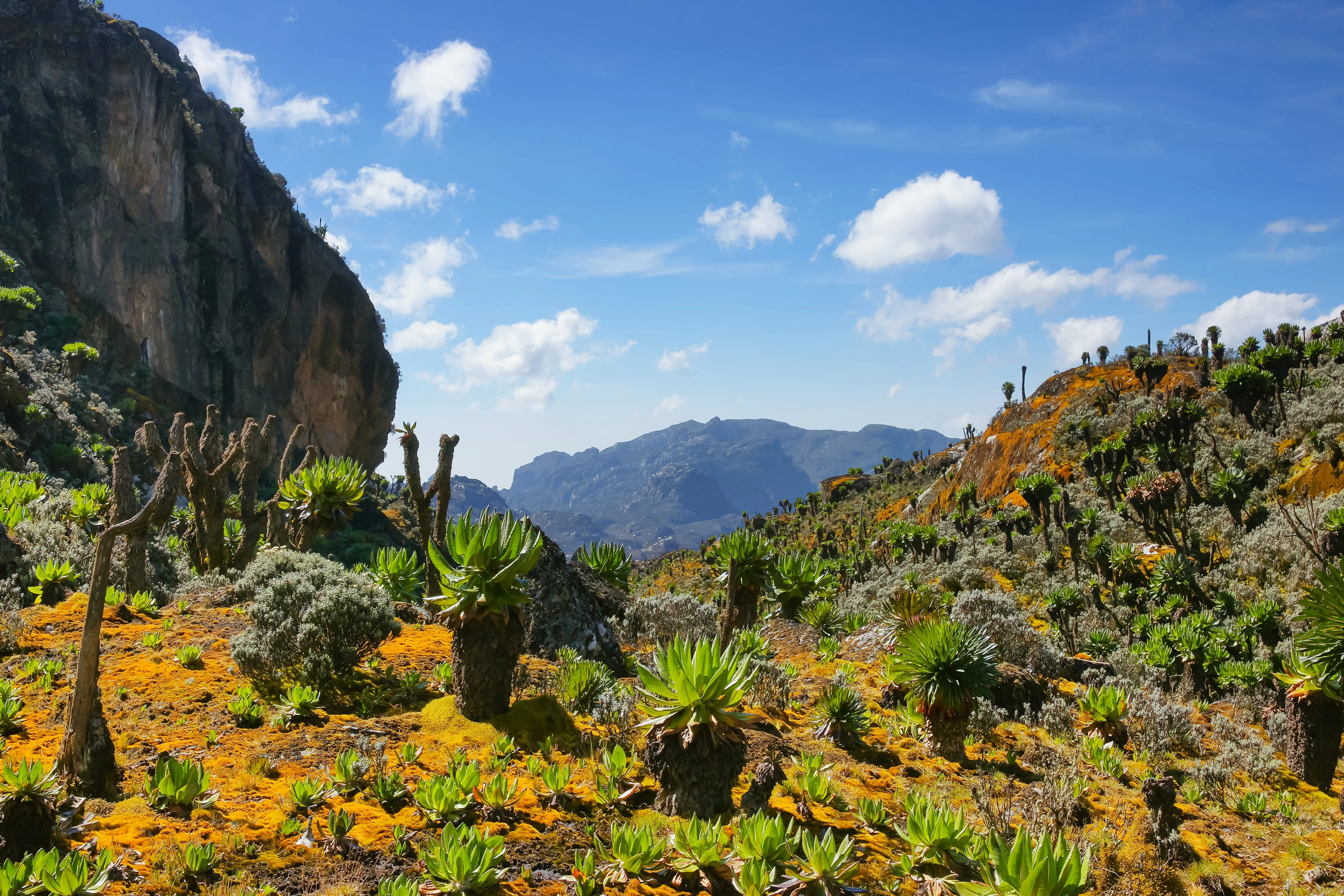
The Rwenzori are unlike any other African mountain range. Permanently snow-capped peaks tower above six dramatic vegetation zones, including the famous Afro-alpine zone of giant lobelia, groundsel, and bearded everlastings that has been called one of the most surreal landscapes on Earth. The Central Circuit trail is the classic 7- to 9-day trek for fit hikers, while the Kilembe Trail offers a quieter alternative on the southern slopes. The mountains also shelter forest elephants, the rare Rwenzori turaco, and the endemic Rwenzori three-horned chameleon.
0
Safari Tours
4.3
Avg Rating
35
Years Protected
Highlights
- Africa's third-highest peak and most surreal alpine landscape
- UNESCO World Heritage Site with extreme biological diversity
- Far less crowded than Kilimanjaro or Mount Kenya
- Glaciers, equatorial snow, and giant lobelia in one trek
- Endemic Rwenzori turaco and three-horned chameleon
Considerations
- Notoriously wet and muddy compared to other African peaks
- Reaching Margherita Peak requires glacier travel and roped sections
- Long approach from Entebbe (8 hours by road)
- Trekking only viable in two narrow drier windows per year
Wildlife
Big Five Status
🦁
Lion
Not present
🐆
Leopard
Not present
🐘
Elephant
Not present
🦬
Buffalo
Not present
🦏
Rhino
Not present
Best Time to Visit
Jan
Feb
Mar
Apr
May
Jun
Jul
Aug
Sep
Oct
Nov
Dec
Peak Season Good Time Less Ideal
Climate Overview
Getting There
Most climbers fly into Entebbe International Airport (EBB) near Kampala and drive 7 to 8 hours west to Kasese or Kilembe, the gateway towns for the Central Circuit and Kilembe routes respectively. Domestic flights to Kasese Airstrip cut transfer time when available.
Nearest Airport
Kasese Airstrip
Nearest City
Kasese
Drive Time
8 hours